Research
HADES - Heloros Advanced Digital Exploration and Surveying
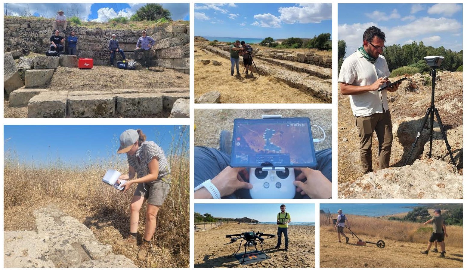
The Heloros Advanced Digital Exploration and Surveying (HADES) is an interdisciplinary collaborative research project aimed at gathering data about the site of the ancient Greek city of Heloros, in Sicily, using digital archaeology techniques and combine such information with existing legacy data to produce new knowledge. As part of the project, legacy excavation data from the 20th century excavations (18,99, 1927, 1958-1959, 1961, 1967-1980) and all the extant archaeological features of the site and its territory are considered to contextualize the findings and improve the technical documentation of such features. All the available information with newly obtained geospatial data and 3D documentation are analyzed on a GIS platform to reconstruct the site's topography and urban layout, revealing new insights into its history.
The project, run in partnership with the Institute for Digital Cultural Heritage Studies of the Ludwig-Maximilians-Universität Munich (Germany) and the Parco Archeologico e Paesaggistico di Siracusa, Eloro, Villa del Tellaro e Akrai, developed through several research campaigns and field works between 2021 and 2023 and it’s still ongoing.
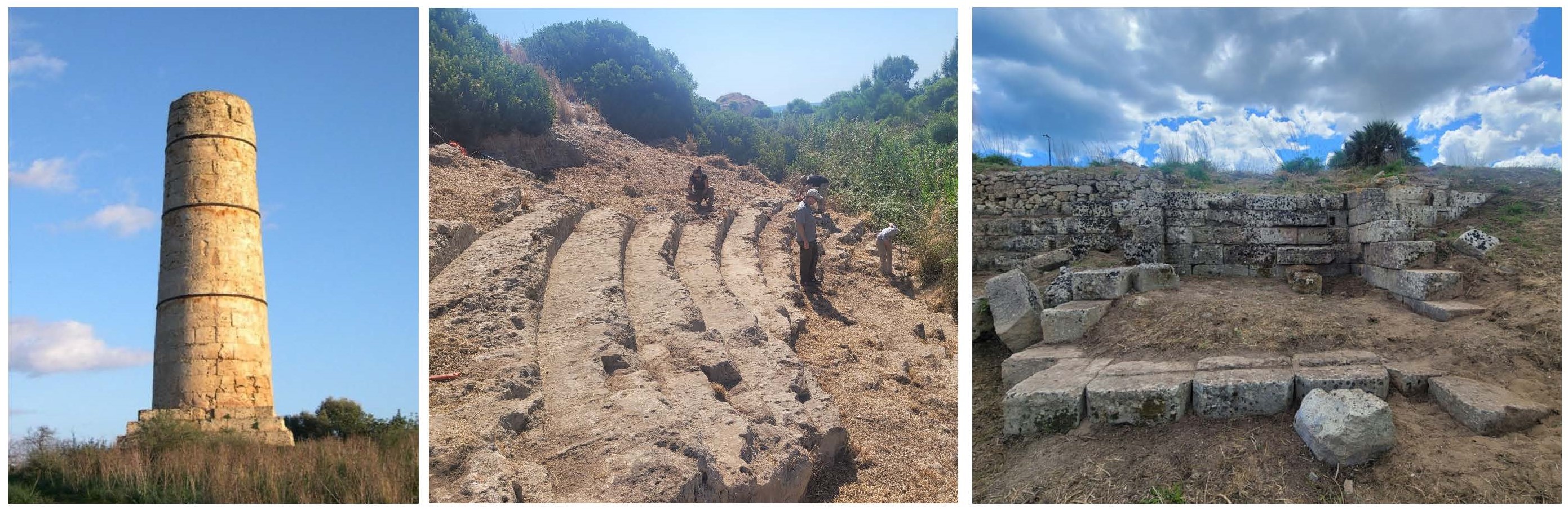
The ancient Greek city of Heloros, in south-eastern Sicily (Noto, Siracusa), founded on a hill by the sea in the late 8th century BCE over the ruins of an indigenous settlement, became, around the 3rd century BCE, a major center with at least three sanctuaries, a theater, an agora surrounded by public buildings and an impressive system of fortification walls. Investigated for the first time in 1899, the site was intermittently explored until the 1980s, uncovering the urban features on the hill, alongside the identification of cemeteries, quarries and a road system in its environs. But the lack of publications and the long hiatus in the fieldworks pushed Heloros to the margins of the scientific discourse. To tackle this issue, HADES focuses on the 'digital excavation' of Heloros.
Digtal excavation is a novel multilayered process that aims to enhance the archaeological investigation without the need for physical excavations and employing various remote and proximal sensing techniques, such as satellite imagery, low-altitude photography, terrestrial and aerial LiDAR and digital photogrammetry, ground-penetrating radar and Geographic Information System techniques
Further readings:
D. Tanasi, S. Hassam, D. Calderone, P. Trapani, N. Lercari, F. Jimenez Delgado, R. Lanteri 2023, Datafication of an ancient Greek city: Multi-sensorial Remote Sensing of Heloros (Sicily), in J.-J. Rousseau, B. Kapralos (eds), Pattern Recognition, Computer Vision, and Image Processing. ICPR 2022 International Workshops and Challenges, Montreal, QC, Canada, August 21–25, 2022, Proceedings, Part IV, Lecture Notes in Computer Science 13645, Springer), pp. 131-141.
N. Lercari, D. Tanasi, T. Sonnemann, S. Hassam, D. Calderone, P. Trapani, L. Ruider, R. Lanteri 2024, Archaeology of Archaeology at Heloros: Re-interpreting the Urban Layout of a Complex Greek Settlement in Sicily using Proximal Sensing and Data Fusion, Digital Applications in Archaeology and Cultural Heritage 33, pp. 1-14
3D Resources:
Aerial digital photogrammetry of the site