Research
Gray 2 Green (G2G)
A decision support tool for transitioning to vegetation-based stormwater management.
Downloads:
BMP Scenario Analisys Tool
Green Infrastructure (greeninfrastructurev2.1.esriaddin)
G2G IS A SUITE OF TOOLS AND RESOURCES THAT ALLOWS USERS TO:
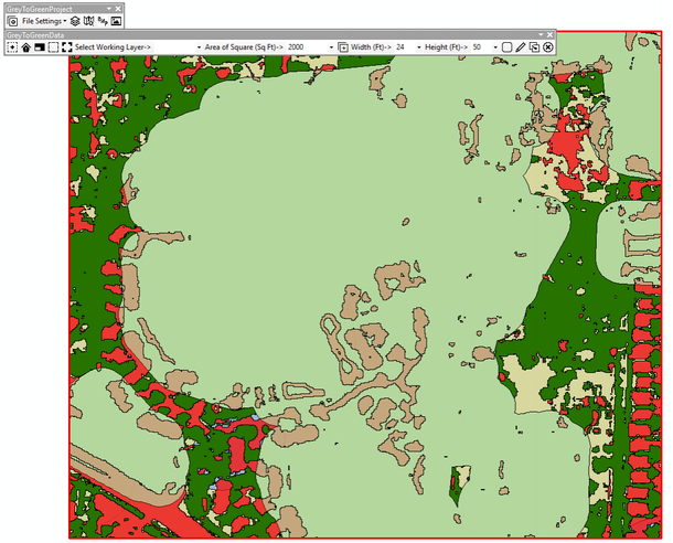
Site Potential BMPS
Using nationally-available soil and land use data layers, this ArcGIS add-in allows users to identify the range of green infrastructure BMPs that are appropriate for their development/redevelopment project. Development plans can be uploaded or quickly replicated using the handing drawing features incorporated in the project toolbar.
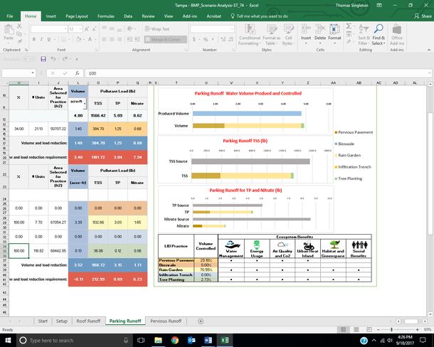
Test BMP Scenarios
After identifying which BMPs are suitable for the development/redevelopment site, the G2G Scenario Analysis Tool allows users to determine the impacts of various treatment options working alone or as part of a treatment train. Working from the source outward, users can see how their management decisions impact stormwater runoff volumes and quality.

Share Results
The G2G siting tool generates an easy-to-share PDF report which allows the reader to select and deselect map output layers regardless of his/her GIS capabilities Similarly, the G2G Scenario Analysis tool a standard office spreadsheet program to allow the user to visualize the impacts of on-the-fly BMP changes.