Written by: Sarah E. Grasty, COMIT Outreach Manager
Earlier this month (laboring through Labor Day weekend), staff and students from the Center for Ocean Mapping and Innovative Technologies (COMIT) at the USF College of Marine Science (CMS) sailed aboard the R/V WT Hogarth to collect data in support of a potpourri of objectives.
The cruise departed with a diverse set of tasks including mapping the future deployment sites for the huge Shallow Underwater Buoys for Geodesy (SUBGEO) currently resting on the CMS peninsula and prospecting reference sites for multibeam echosounder backscatter. Each task incorporated innovative uses of oceanic gliders – the oft underappreciated workhorses of oceanography. At any one time, there’s likely to be a dozen or so oceanic gliders see-sawing through global waters, collecting data continuously for weeks or months at a time. They could be measuring anything from temperature and salinity to the density of fish in an area.
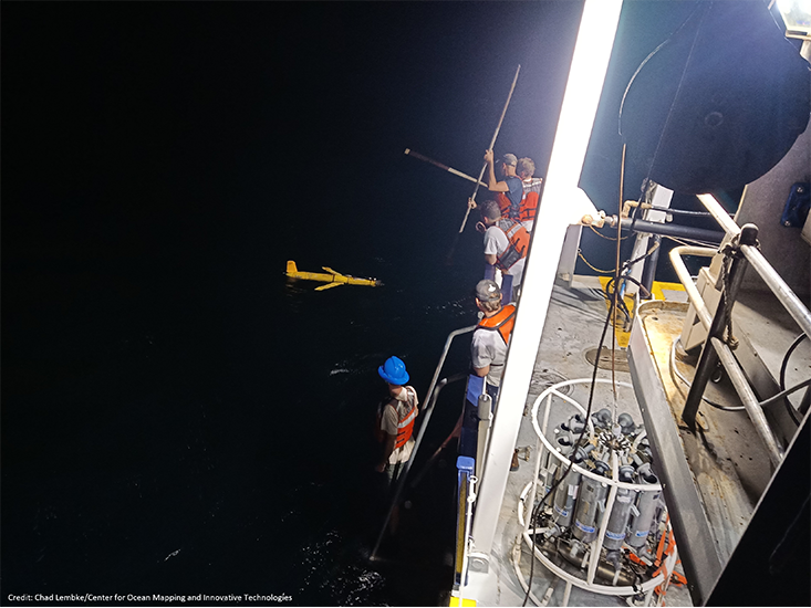
Above: A nighttime glider deployment. PHOTO CREDIT: Chad Lembke, Center for Ocean Mapping and Innovative Technologies.
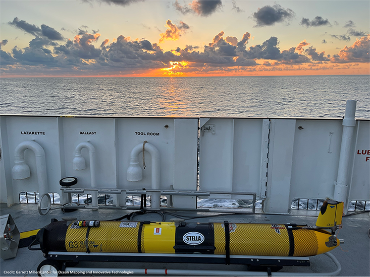
The dynamic glider duo aboard this cruise was Stella and Sam. Both were equipped with a CTD (to measure temperature, depth, salinity), fluorometer (to measure phytoplankton concentrations), and a dissolved oxygen sensor. Stella was also equipped with an EK Mini – an echosounder used to fill the water column with sound. Not all acoustic sensors lend themselves to calibration, meaning the data can be related to some kind of standard and reliable inferences can be made from the results. But an EK Mini can. Using a “glider pontoon,” the glider-mounted echosounder can bob away with a metal calibration sphere dangling beneath, allowing scientists to relate the returns from the echosounder to a target with a known mass. Once calibrated, the glider with its EK Mini can hop off the pontoon and get to work.
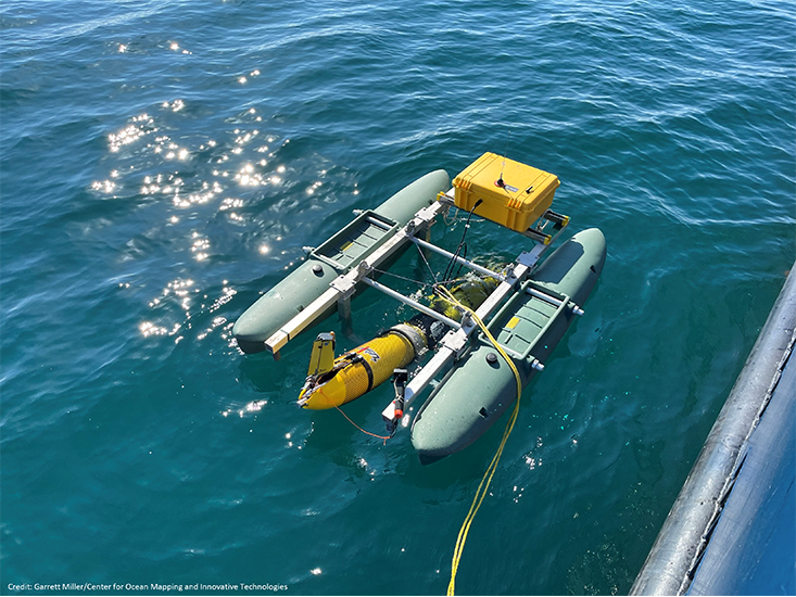
Above: Stella onboard the glider pontoon being readied for the EK Mini calibration. PHOTO CREDIT: Garrett Miller, Center for Ocean Mapping and Innovative Technologies.
Addressing longtime issues of uncalibrated data
The calibratable nature of the EK Mini on Stella was important to another instrument onboard (well, technically under) the R/V WT Hogarth – a multibeam echosounder (MBES). Multibeam systems are used to collect seafloor depth data, or bathymetry, but they also produce backscatter data which provide information on the texture and composition of the seafloor. Backscatter data are one of those sonar-based datasets that are difficult, if not often impossible, to calibrate. This means that datasets collected separately cannot be reliably related to one another. Imagine the headaches if you couldn’t relate the bathymetry data from one area to another.
Chief scientist and lead for the CMS glider program, Chad Lembke explains, “Our intent was to test whether using backscatter data from a sensor that can be calibrated, the EK Mini in this case, could be used to retroactively calibrate the backscatter data from an uncalibrated sensor, like on a multibeam system.”
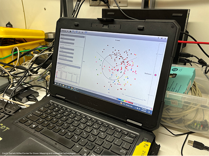
Above: The calibration software shows how many times the sphere has been “hit” with the sonar and where the sphere was detected. It’s important to have it move around so that the sonar beams are hitting the calibration sphere at different angles. PHOTO CREDIT: Garrett Miller, Center for Ocean Mapping and Innovative Technologies.
If successful, this could open a flood gate of new applications and use of multibeam backscatter data, such habitat classification. With Stella out collecting data in the same area, lead MBES scientists Stephan O’Brien and Matthew Hommeyer (joining the cruise remotely from shore – modern technology for the win!) used the system to collect concurrent bathymetry and backscatter data.
Remember that this cruise had a docket of varied tasks? This is where the “two birds, one stone” motto comes in. The area where the MBES and Stella were collecting data was in the proposed location of a new buoy that fellow COMIT scientist Tim Dixon, Distinguished University Professor and director of the USF Natural Hazards Network, is hoping to deploy the SUBGEO-2. This buoy is designed to measure extremely small changes in seafloor displacement – the precursor to earthquakes and tsunamis – but needs to be tested before moving forward. The data collected during the cruise in this area will not only help inform the backscatter calibration project, but also provide Dixon and his SUBGEO-2 team with the necessary information about their proposed buoy location. They need to know what the seafloor looks like and ensure there are no sensitive habitats where the large, heavy anchor will be deployed.
Innovative applications of traditional technology
In accordance with a common ocean observing philosophy, “collect once, use many times,” both gliders had another task: collecting CTD data (which is their most common use). Sam was deployed earlier in the cruise to roam around the SUBGEO-2 region, peacefully yo-yoing away while collecting temperature and salinity profiles. Occasionally the team would receive the data in near real-time when the glider surfaces and connects to a satellite data link.
When using a MBES to map the seafloor, sound velocity is a key piece of supplemental data required for correcting the depth measurements. Typically, sound velocity profiles, or SVP’s, are taken using a sensor that is lowered to and from the seafloor while the vessel is stationary (which eats up precious ship time) or underway with a special type of winch (which can be expensive and requires specialized set-up).
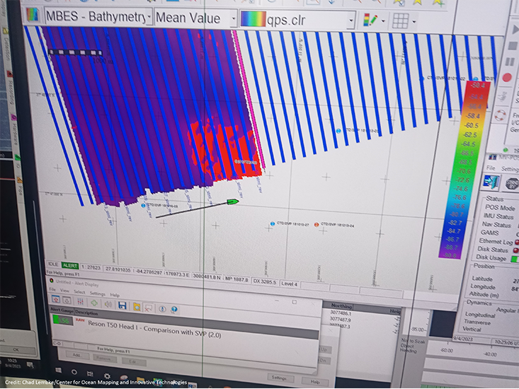
Above: Watching the mapping data come in can be like doing the world’s slowest scratch-off card. But it can also be exciting! Especially when there are interesting seafloor features to investigate. PHOTO CREDIT: Chad Lembke, Center for Ocean Mapping and Innovative Technologies.
Lembke and his team, Alex Silverman, Garrett Miller, and Sean Beckwith, deployed the gliders in the area to investigate whether sound velocity calculated using the glider’s sensors was comparable to the SVP’s collected via traditional means. The idea here is that deploying a glider that can meander in the survey area and send data via satellite could allow scientists on board the ship can get those data without having to stop mapping. Garrett and Sean, both CMS graduate students, worked on algorithms to convert the glider CTD data into SVP format for the multibeam echosounder. Is this method of combining an autonomous glider with a mapping platform just as good as traditional methods? The jury is still out, but Lembke and the team say their preliminary results are promising.
By the end of day three, Stella and Sam had completed their tasks and were brought back on board. Before heading back into port, the crew spent the last three days collecting more multibeam bathymetry data in select locations offshore of Tampa Bay in support of upcoming projects at COMIT, NOAA, and beyond; data which may help establish a reference site to be used by any local collaborators to check their sonar systems.
The COMIT team would like to thank the Florida Institute of Oceanography’s R/V WT Hogarth crew for their support during this field effort.
The datasets from this cruise are being analyzed already with more results expected over the coming months – so stay tuned to COMIT’s socials and newsletter to hear the latest!
Keep up with COMIT via LinkedIn (COMIT | Center for Ocean Mapping and Innovative Technologies). Twitter/X (@COMITusf), and via their quarterly newsletter.