Fisheries and Ecosystem Ecology Lab
Ecosystem modeling
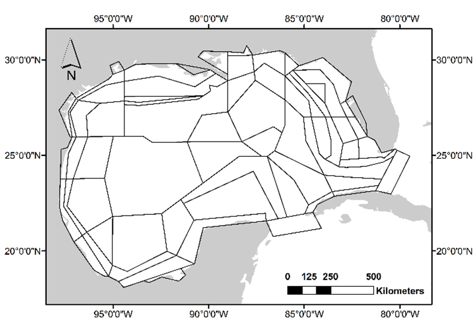
Gulf of Mexico Atlantis model polygon geometry.
Our lab uses quantitative ecosystem modeling tools including Atlantis. Atlantis is an “end-to-end” ecosystem model in that it considers all parts of the marine ecosystem: biophysical, economic and social. It is used extensively in the United States in NOAA’s Integrated Ecosystem Assessment (IEA) Program, fisheries stock assessment, marine reserve planning, and ecological hypothesis testing. Atlantis includes detailed bottom-up processes which makes it well suited to study impacts of climate change, pollution, red tides, river discharge, and other natural and anthropogenic processes and pressures. We have developed the Gulf of Mexico Atlantis model over the last 10+ years. It has been used for numerous publications and dissertations. Atlantis is spatial (3D) and uses irregular polygons for computational efficiency. Atlantis is developed and maintained by CSIRO Australia.
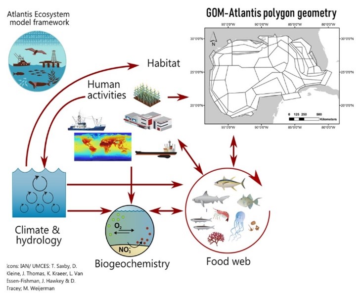
Atlantis consists of numerous sub-models representing biogeochemistry, physics, ecology and human activities.
The food web model Ecopath with Ecosim (EwE) is another important ecosystem modeling tool. Dr. Ainsworth features EwE in his Ecosystem Modeling course, which he offers in odd years. This course is offered remotely to international students. The Ainsworth Lab and the College of Marine Science hosted the Ecopath35 Conference in St. Petersburg in Dec 2019. It drew attendance from 110 scientists/students from 25 countries and six continents.
Further reading
Fulton, E.A., Link, J.S., Kaplan, I., Savina-Rolland, M., Johnson, P., Ainsworth, C.H., Horne, P., Gorton, R., Gamble, R.J., Smith, A.D.M. and Smith, D.C. (2011). Lessons in Modelling and Management of Marine Ecosystems: The Atlantis Experience. Fish and Fisheries, 12(2): 171-188.