Written By: Dyllan Furness, Science Communication Manager | The Florida Flood Hub
Some 150 miles off the coast of Florida in the Gulf of Mexico, an uncrewed yellow submersible dives deep below the sea surface. Its mission: collect data for hurricane forecasting.
The submersible, which began its three-month deployment in July, is part of an eight-vessel research fleet operated by the Center for Ocean Technology (COT) at the University of South Florida College of Marine Science (USF CMS). Starting this season, COT will receive around $200,000 over two years from the National Oceanic and Atmospheric Administration (NOAA) to monitor ocean conditions in the eastern Gulf of Mexico and along the South Atlantic Bight, which stretches from North Carolina to the Florida Keys.
Semiautonomous vessels operated by COT and other NOAA partners will capture key data to help the federal agency improve the representation of the ocean and atmosphere in hurricane forecast models. COT collected these data in the past, but this is the first year the team deploys submersibles specifically for this purpose.
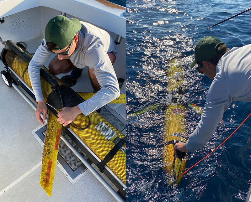
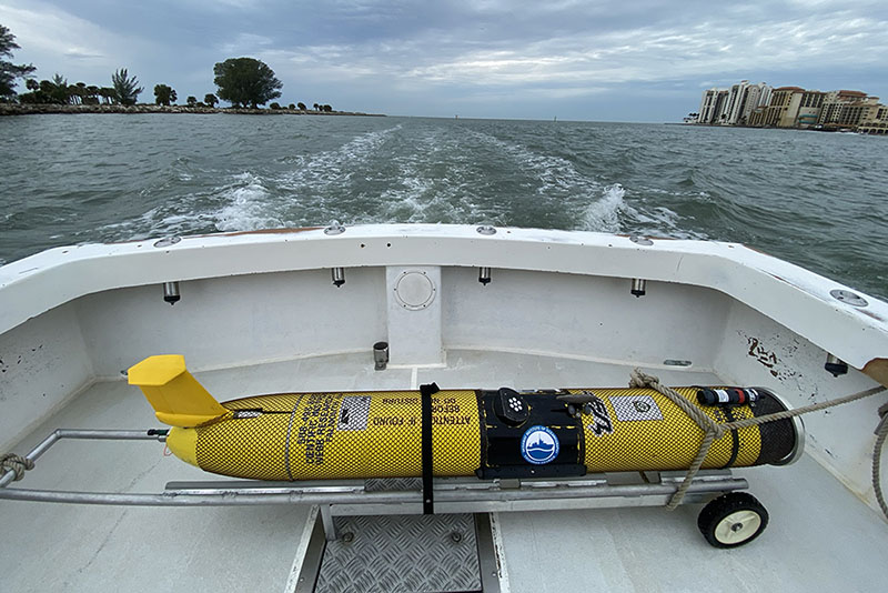
The College of Marine Science operates a fleet of eight semiautonomous gliders in the Gulf of Mexico and Atlantic Ocean, where they capture key data about ocean conditions. PHOTO CREDIT: Jessica Van Vaerenbergh, USF CMS graduate student.
Called gliders for the graceful way they move through water, each COT vessel can travel hundreds of miles on months-long missions and send data back to shore via satellite. Since gliders have no people on board, they have greater endurance, fewer risks, and lower costs than crewed vessels.
“Gliders are one of the most cost effective and reliable ways to gather subsurface data,” said Chad Lembke, a project engineer at COT. “They can cover many miles from the surface to the seafloor with little input needed from human operators.”
Read more: Keeping our eyes on hurricanes
This ability to traverse the water column makes gliders valuable for hurricane research and monitoring. Hurricanes require ocean temperatures of 79 degrees Fahrenheit or higher to form and sustain their strength. Warm waters provide energy to turn tropical storm systems into powerful hurricanes, and the deeper the warm water reaches into the water column, the more fuel at the storm’s disposal.
“Scientists have realized that water ‘at depth’ is an important factor in hurricane intensification,” said Lembke. “By using gliders to measure the depth of warm water, researchers can better quantify the total heat content available to storms, which helps NOAA’s hurricane forecasters better understand whether a storm will increase in strength as it approaches landfall.”
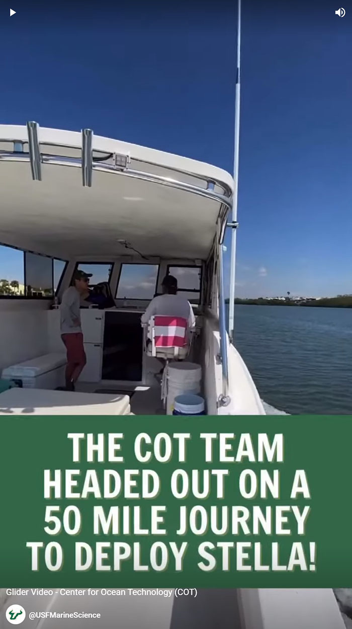
Take a trip on a glider deployment in the Gulf of Mexico. Click on the image above to view the YouTube shorts video.
In addition to temperature, gliders monitor ocean salinity, another key metric that helps experts predict hurricane intensity. Research has shown that areas of low salinity can cause storms to intensify and trigger rapid intensification, a dangerous phenomenon during which a storm’s top wind speed increases by 35 mph in a single day. Hurricane Ian went through two bursts of rapid intensification before it made landfall in southwest Florida last year.
Read more: How the College of Marine Science responded to Hurricane Ian
“Fresh water from nearby rivers can have an influence on the ocean's ability to mix up colder, deeper waters that might help reduce a storm's strength,” said Kathy Bailey, a program manager for NOAA’s U.S. Integrated Ocean Observing System, which leads the glider effort. “We are able to ‘see’ these features in glider measurements of temperature and salinity. We need accurate ocean and atmosphere models to forecast hurricane intensity — these measurements are used to help keep the ocean models on track, so we have the best chance of producing an accurate hurricane intensity forecast with the best ocean information possible.”
Gliders are good for monitoring more than hurricanes. They’re packed with a suite of onboard sensors that assist with assessments of water quality, fisheries management, and ocean circulation models. Lembke compares gliders to pickup trucks for the way his team can load them up with instruments.
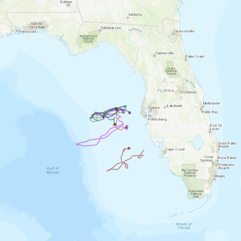
2022 was a banner year for the College of Marine Science’s glider fleet, and NOAA’s funding will help support another active season. This map depicts last year’s deployments in the Gulf of Mexico.
Since 2020, as part the College’s Center for Red Tide Tracking and Forecasting effort, gliders operated by USF CMS have been focused on helping scientists monitor red tide, which has had devastating impacts on marine life and economies along Florida’s Gulf Coast. Data about physical and chemical properties such as temperature, salinity, and dissolved oxygen has been used to refine computer models that predict red tide development.
NOAA’s funding is well-timed. Experts predict 14-21 named storms this year, including up to five major hurricanes. Those predictions are in part driven by above-average temperatures in the Atlantic Ocean and Caribbean Sea.
The new funding, which supports one deployment in the Gulf of Mexico and two in the Atlantic Ocean, allows COT to focus its gliders on gathering data to improve hurricane forecasting and enable communities to better prepare for storms.