Research
Philippe Park Living Shoreline
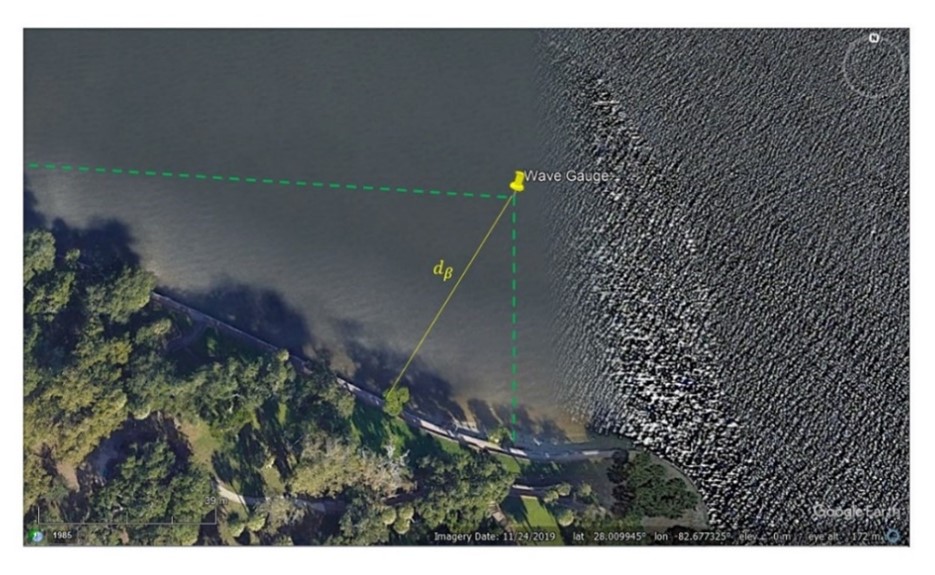
Figure 1. The position of the wave gauge (yellow) near the sea wall of Philippe Park, and some geometric values are indicated.
- Quantify impact of living shoreline on wave environment
- Use advanced data methods to identify boat wakes and wind waves
- Measure wave energy reflected from the seawall
CMPS is working with Pinellas County, the Tampa Bay Estuary Program, and the National Fish and Wildlife Foundation to evaluate benefits of living shorelines being installed at Philippe Park, Safety Harbor, FL. Living shorelines are valued for their ability to protect vulnerable shoreline and coastal communities from storm surge and wave action. Safety Harbor is home to a growing population, attracts a lot of recreational boating, and hosts the temple mound of the Tocobaga people. To support shoreline protection efforts in Philippe Park, CMPS personnel built and deployed a high frequency wave gauge array to measure the present-day wave environment. They have an ongoing program to analyze the measurements to determine wave frequency, strength and direction, as well as distinguish boat wakes from wind-driven waves. These “before” measurements will be compared to those taken after installation of the living shoreline.
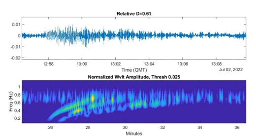
Figure 2. Water levels during the passage of a boat wake (top) and the wavelet amplitude of the signal (bottom).